
- The SWOT satellite, a collaboration between NASA and CNES, offers unprecedented clarity in mapping Earth’s ocean floors.
- Launched in 2022, SWOT provides extensive data that enhances our understanding of underwater topographies and global water levels.
- Using advanced gravimetric techniques, SWOT reveals features like abyssal hills and seamounts, covering 70% of the ocean floor.
- These advancements improve global navigation and communication, aiding submarines and the maintenance of telecommunication cables.
- SWOT’s dual mission in oceanography and hydrology represents the first comprehensive evaluation of Earth’s surface water.
- As SWOT continues to deliver insights, it underscores humanity’s role in exploring, understanding, and preserving our blue planet.
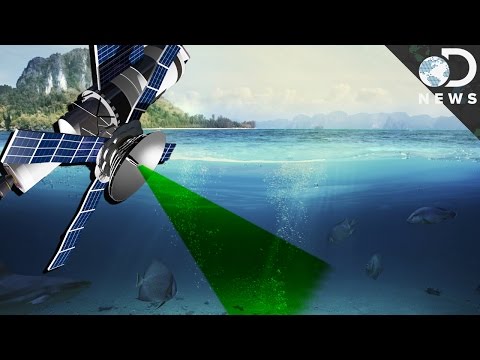
From the vast, mysterious depths of Earth’s oceans emerges a breathtaking revelation: thanks to the pioneering efforts of NASA and the French space agency CNES, we are now gazing upon the ocean floor with unprecedented clarity. The Surface Water and Ocean Topography (SWOT) satellite, launched in 2022, has showered scientists with a deluge of data, painting a new and vibrant picture of our planet’s submerged landscapes.
Imagine the globe as a marvelously intricate puzzle, its pieces hidden beneath miles of saltwater. Until now, countless gaps have obscured our understanding of these abyssal wonders. Previously, even the moon was mapped more comprehensively than Earth’s oceanic depths. But with SWOT’s groundbreaking technology, researchers are stitching together these elusive pieces, transforming our knowledge of what lies beneath.
In an enchanting video release, NASA unfurls this newfound vision: a dynamic animation that charts the seafloor around Mexico, South America, and the frigid Antarctic Peninsula. The imagery pops with vitality, employing green and purple hues to render an intricate tapestry of undersea features. These visuals are more than just scientific art; they offer practical improvements for global navigation and communication. Submarines can now maneuver through previously uncharted territories with greater precision. Meanwhile, the arduous task of laying and maintaining telecommunication cables—a lifeline for our interconnected world—becomes less perilous.
At the heart of this achievement is SWOT’s ability to detect undersea features by measuring subtle gravitational variations across the ocean’s surface. Abyssal hills, born from the slow dance of tectonic plates, and seamounts, the ocean’s volcanic sentinels, shine through this innovative gravimetric method. Astonishingly, these humble hills cover an expansive 70% of the ocean floor, making them Earth’s most common landform. For years, the challenge of documenting these features was likened to finding individual grains of sand in a vast desert.
The challenge of mapping these underwater topographies using ships and sonar has proven laborious and incomplete, covering only a fraction of our oceanic world. In contrast, SWOT not only unveils these hidden formations but also surveys global water levels—an endeavor that marks the first comprehensive evaluation of Earth’s surface water. This dual mission enhances our understanding of oceanography and hydrology, illuminating both the ocean’s silent depths and its gleaming surface.
In an era where technology propels us ever forward, the revelations from SWOT promise to shape the future of ocean science. As data continue to flood into the hands of researchers, the ocean relinquishes more of its long-guarded secrets. With each insight, we are reminded of our role as stewards of this blue planet, forging connections not just across continents but with the very essence of Earth itself.
In revealing the hidden beauty and complexity of our world’s underwater landscapes, SWOT stands as a testament to human ingenuity and our relentless quest for knowledge. As the ocean floor comes into clearer focus, we glimpse a panorama both wondrous and profound, inviting us to explore, understand, and protect the depths that sustain us.
Unlocking the Ocean’s Depths: How the SWOT Satellite is Revolutionizing Ocean Exploration
Introduction
The exploration of Earth’s oceans has reached a new milestone, thanks to the innovative Surface Water and Ocean Topography (SWOT) satellite from NASA and the French space agency CNES. Launched in 2022, SWOT provides a vivid, data-rich depiction of underwater landscapes, resolving areas previously more mysterious than even the moon’s surface. This technological marvel offers practical solutions for global navigation and telecommunications, and deepens our understanding of oceanography and hydrology.
Key Insights and Applications
1. Enhanced Seafloor Mapping:
SWOT’s ability to measure tiny variations in sea surface elevation uncovers details about the ocean floor that were previously unimaginable. This technology outperforms traditional ship-based sonar mapping, which only covers a limited portion of the ocean.
2. Significant Features Revealed:
Scientists can now visualize abyssal hills and seamounts using gravimetric data. These features, covering approximately 70% of the ocean floor, form the most common landforms on the planet and play crucial roles in oceanic currents and ecosystems.
3. Implications for Submarine Navigation and Cable Laying:
With clearer seafloor maps, submarines can navigate with improved safety and precision. The intricate task of laying undersea cables becomes far less hazardous, reducing the risk of damage and disruption to global internet and communication networks.
4. Global Water Level Monitoring:
By providing the first-ever comprehensive measurement of global surface water levels, SWOT contributes to improved climate modeling and resource management. This dual-purpose mission blends oceanography and hydrology, shedding light on our planet’s water systems.
Real-World Use Cases
– Climate Research: SWOT data aids scientists in understanding sea level rise and enhances predictive weather models by incorporating comprehensive water level data across the globe.
– Marine Conservation: Through better maps, environmentalists can identify critical marine habitats that need protection, helping to safeguard biodiversity.
– Disaster Management: With precise data on water levels, SWOT can assist in forecasting and mitigating the impacts of natural disasters, such as tsunamis and hurricanes.
Industry Trends and Future Outlook
– Growing Satellite Technology Market: As technology advances, the demand for high-resolution, satellite-derived topographic maps will likely expand, driving innovation in both the public and private sectors.
– Integration with AI and Big Data: Machine learning algorithms can process SWOT’s data faster, leading to quicker insights and enabling real-time applications such as monitoring illegal fishing activities.
Challenges and Limitations
– Data Overload: The massive volume of data generated by SWOT poses a challenge in processing and analysis, requiring advances in computational methods.
– Cost of Technology: Developing and deploying satellites like SWOT involves significant financial investments, which can limit participation to wealthy nations or require international collaboration.
Actionable Recommendations
– Support Collaborative Efforts: Encourage international partnerships and data-sharing initiatives to maximize the benefits of SWOT’s findings.
– Invest in Computational Resources: Develop and invest in technologies to handle and analyze large datasets effectively.
– Promote Public Awareness: Raise awareness about the importance of ocean mapping for sustainable development and environmental conservation.
For further information about NASA’s initiatives and updates on satellite technology, visit the NASA website.
The continuous data flow from SWOT highlights our planet’s interconnectedness and our role as caretakers of Earth’s ecosystems. By embracing this knowledge, we can make informed decisions to protect our planet’s precious water resources.