
- SWOT satellite, NASA and CNES collaboration offers incredible clarity in mapping the ocean floor of the Earth.
- Launched in 2022, SWOT provides a vast amount of data that enhances our understanding of underwater topographies and global water levels.
- Using advanced gravitational techniques, SWOT reveals features such as abyssal hills and seamounts that cover 70% of the ocean floor.
- These achievements improve global navigation and communication, aiding submarines and the maintenance of telecommunications cables.
- SWOT’s dual mission in oceanography and hydrology is the first comprehensive assessment of Earth’s surface water.
- While SWOT provides insights, it highlights humanity’s role in exploring, understanding, and safeguarding our blue planet.
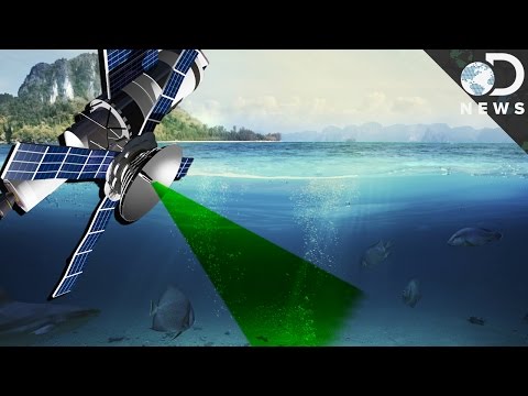
From the vast, mysterious depths of the Earth’s oceans emerges an impressive idea of liberation: thanks to the innovative efforts of NASA and the French space agency CNES, we are now looking at the ocean floor with incredible clarity. The Surface Water and Ocean Topography (SWOT) satellite, launched in 2022, has provided scientists with a tremendous flow of data that has painted a new and vivid picture of our planet’s hidden landscapes.
Imagine the Earth as a wonderfully complex puzzle, with pieces hidden beneath miles of saltwater. Until now, countless gaps have clouded our understanding of these abyssal wonders. Previously, even the Moon had been mapped in greater detail than the depths of the Earth’s oceans. However, with SWOT’s innovative technology, researchers are solving these mysteries, transforming our knowledge of what lies beneath the surface.
In an exhilarating video, NASA unveils this newly discovered vision: a dynamic animation that marks the ocean floor around Mexico, South America, and the frigid Antarctica. These visions pulse with life, using greens and purples to create a complex tapestry of underwater structures. These images are more than just scientific art; they offer practical enhancements to global navigation and communication. Submarines can now maneuver through previously unknown territories with greater precision. Meanwhile, the intricate task of laying and maintaining telecommunications cables, which is a lifeline in our interconnected world, becomes less perilous.
At the heart of this achievement is SWOT’s ability to detect underwater features by measuring subtle changes in gravity at the ocean’s surface. Abyssal hills, formed from slow tectonic plate dances, and seamounts, the ocean’s volcanic sentinels, shine through this innovative application of gravitational methods. Remarkably, these modest hills cover a staggering 70% of the ocean floor, making them the most prevalent landform on Earth. For many years, documenting these features was akin to searching for individual grains of sand in a vast desert.
Mapping these underwater topographies using ships and sonar has been extremely challenging and incomplete, covering only a small portion of our oceanic world. Meanwhile, SWOT not only reveals these hidden forms but also examines global water levels—a endeavour that marks the first comprehensive assessment of Earth’s surface water. This dual mission enhances our understanding of both oceanography and hydrology, illuminating both the ocean’s silence and its sparkling surface.
In an era of technology that continually pushes us forward, SWOT’s revelations promise to shape the future of marine science. As data continues to flow into researchers’ hands, the ocean yields more of its long-guarded secrets. Each insight reminds us of our role as stewards of this blue planet, forging connections not just between continents, but with the Earth itself.
By unveiling the hidden beauty and complexity of our world’s underwater landscapes, SWOT has become a testament to human ingenuity and the unending quest for knowledge. As the ocean floor becomes clearer, we are reminded of the wondrous and profound panorama that invites us to explore, understand, and safeguard the depths that sustain us.
Opening the Ocean Depths: How the SWOT Satellite is Revolutionising Ocean Research
Introduction
Exploration of the Earth’s oceans has reached a new stage, thanks to the innovative Surface Water and Ocean Topography (SWOT) satellite from NASA and the French space agency CNES. Launched in 2022, SWOT provides a vivid, data-rich view of underwater landscapes, addressing areas that have until now been more mysterious than the surface of the Moon. This technological marvel offers practical solutions for global navigation and telecommunications while deepening our understanding of oceanography and hydrology.
Key Insights and Applications
1. Enhanced ocean floor mapping:
SWOT’s ability to measure small changes in sea surface height reveals details about the ocean floor that were previously unimaginable. This technology surpasses traditional ship-based sonar, which covers only a limited portion of the ocean.
2. Revealing important features:
Scientists can now visualise abyssal hills and seamounts using gravitational data. These features, covering about 70% of the ocean floor, are the most common landforms on the planet and play vital roles in the context of oceanic currents and ecosystems.
3. Impact on submarine navigation and cable laying:
With clearer maps of the ocean floor, submarines can navigate with greater safety and accuracy. The complex process of laying underwater cables becomes much less hazardous, reducing the risk of damage and disruptions in our interconnected world.
4. Global water level monitoring:
By providing the first comprehensive measurements of global surface water levels, SWOT contributes to better climate modelling and resource management. This dual mission connects oceanography and hydrology, illuminating the complexity of our planet’s water systems.
Real-World Use Cases
– Climate research: SWOT data helps scientists understand sea level rise and improves weather forecasting models by incorporating detailed water level data from around the globe.
– Marine conservation: Better maps enable conservationists to identify critical marine habitats in need of protection, helping to preserve biodiversity.
– Disaster management: With accurate water level data, SWOT can aid in predicting and mitigating the impacts of natural disasters, such as tsunamis and hurricanes.
Industry Trends and Future Outlook
– Growing satellite technology market: With the pace of technological advancement, there is an increasing demand for high-resolution, satellite topographic mapping, driving innovation in both the public and private sectors.
– Integration with artificial intelligence and big data: Machine learning algorithms can process SWOT data more quickly, leading to faster insights and enabling real-time applications such as monitoring illegal fishing activities.
Challenges and Limitations
– Data overload: The vast amount of data generated by SWOT presents challenges in processing and analysis, requiring advanced computational methods.
– Cost of technology: The development and deployment of satellites like SWOT require significant financial investment, which may limit participation to wealthy nations or necessitate international collaboration.
Effective Recommendations
– Support collaborative efforts: Encourage international partnerships and data-sharing initiatives to maximise the discoveries made by SWOT.
– Invest in computing resources: Develop and invest in technologies to efficiently manage and analyse large datasets.
– Promote public awareness: Increase awareness of ocean mapping efforts necessary for sustainable development and environmental protection.
For more information on NASA initiatives and satellite technologies, visit the NASA website.
The continuous flow of SWOT data underscores the interconnectedness of our planet and our role as stewards of Earth’s ecosystems. By embracing this knowledge, we can make informed decisions to protect our planet’s valuable water resources.